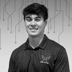
THE GRYFN TEAM
Insights from a high quality,
high capacity data platform.
Most drone imaging companies in
agriculture focus on the production scale
or operator level, we’re starting at the
other end — we’re delivering complex,
multiple high end sensing technologies to
generate reliable, accurate and precise
data for actionable research. Research
that will eventually benefit
the producer.

MATT BECHDOL
CEO
BS in Public Affairs from Indiana University, MS in Geographic and Cartographic Science from George Mason University, MBA from Indiana University, and MS in Agricultural Economics from Purdue University
Specializes in spatial data analysis and remote sensing technologies for agriculture and natural resources
Previous consulting, leadership and teaching roles within geographic information systems and “Big Data”
Believes weekends are for analog technology, map-geek, occasional hops-grower

GRYFN is an innovator
in multi-modal remote sensor integration, with a focus on hyperspectral.
The real benefit of our systems comes from the operational expertise -
taking what are traditionally difficult
to use technologies and streamlining
workflows so researchers can perform consistent, repeatable
data collection with
minimal downtime.
RYAN RILEY
Director of Flight Operations and Customer Success
BS in Unmanned Aerial Systems & Minor in Air Traffic Control from Purdue University
Specializes in system testing and integration,
flight operations, and customer support
Leads GRYFN's most challenging field operations and enables customers to extract the most from their systems
On weekends, he can be found on the slow pitch softball diamond or at a craft brewery

Cutting edge technology.
There’s plenty of other companies out
there who have the capability to collect
RGB and LIDAR simultaneously or LIDAR
and hyperspectral simultaneously,
but no other U.S. companies are doing
all three on a single platform.
GAVIN HO
Pilot and GIS Analyst
BS in Unmanned Aerial Systems and
Graduate Certificate in Geospatial Information Science from Purdue University
Specializes in Geographic Information Systems, as well as hardware integration engineering & CAD-based design
Experienced in Design Engineering, GIS Applications, & UAS Operations
Plans & Executes GRYFN UAS Missions
Typically spotted lifting weights, spending time outdoors, and hanging out with friends
Geospatial data for all
Our technology streamlines the hardware design, data collection, and analytics software to deliver high-quality remote sensing data. We offer customized, user-friendly pipelines that allow researchers to take maximal advantage of remote sensing data for their projects.

YI-CHUN "JILL" LIN
Applied Scientist
BS and MS in Civil Engineering from National Taiwan University, Taipei, Taiwan
Ph.D. in Civil Engineering from Purdue University
Specializes in remote sensing, photogrammetry, and computer vision
Develops end-to-end software pipeline for mobile mapping systems
Indulges in coffee, music, and volleyball in her spare time

Cutting edge technology.
There’s plenty of other companies out
there who have the capability to collect
RGB and LIDAR simultaneously or LIDAR
and hyperspectral simultaneously,
but no other U.S. companies are doing
all three on a single platform.
KENNETH TUSSEY
Director of Software Engineering
BS in Biochemistry from Indiana University
MS in Biophysics from University of Illinois
Specializes in systems software architecture
Previous counter-UAS, DoD, and GEOINT standards experience
Often found in his natural habitat on the homestead picking guitars, fixing tractors, brewing beer, or riding horses
FOUNDERS

Purdue University
Professor of Agricultural and Biological Engineering and Environmental and Ecological Engineering


Purdue University
Nancy Uridil and Francis Bossu Professor of Civil Engineering
Purdue University
The Charles William Harrison Distinguished Professor of Electrical and Computer Engineering and Professor of Biomedical Engineering
University of Arizona
Chief AI & Data Science Officer and Associate VP for
Research and Partnerships

Purdue University
Thomas A. Page Professor in Civil Engineering & Co-Director of the Civil Engineering Center for UAS Applications for a Sustainable Environment (CE-CAUSE)


MICHAEL LEASURE
Purdue University
Associate Professor of Aviation Technology, Retired
Purdue University
Professor of Plant Breeding & Genetics
Wickersham Chair of Excellence in Agricultural Research
Purdue University
Professor Emeritus, Dept of Agronomy Member, Whistler Center for Carbohydrate Research Member, Purdue Center for Plant Biology
